Tar and Havir lakes; two sisters of freshwater lakes
Tar and Havir lakes; two sisters of freshwater lakes
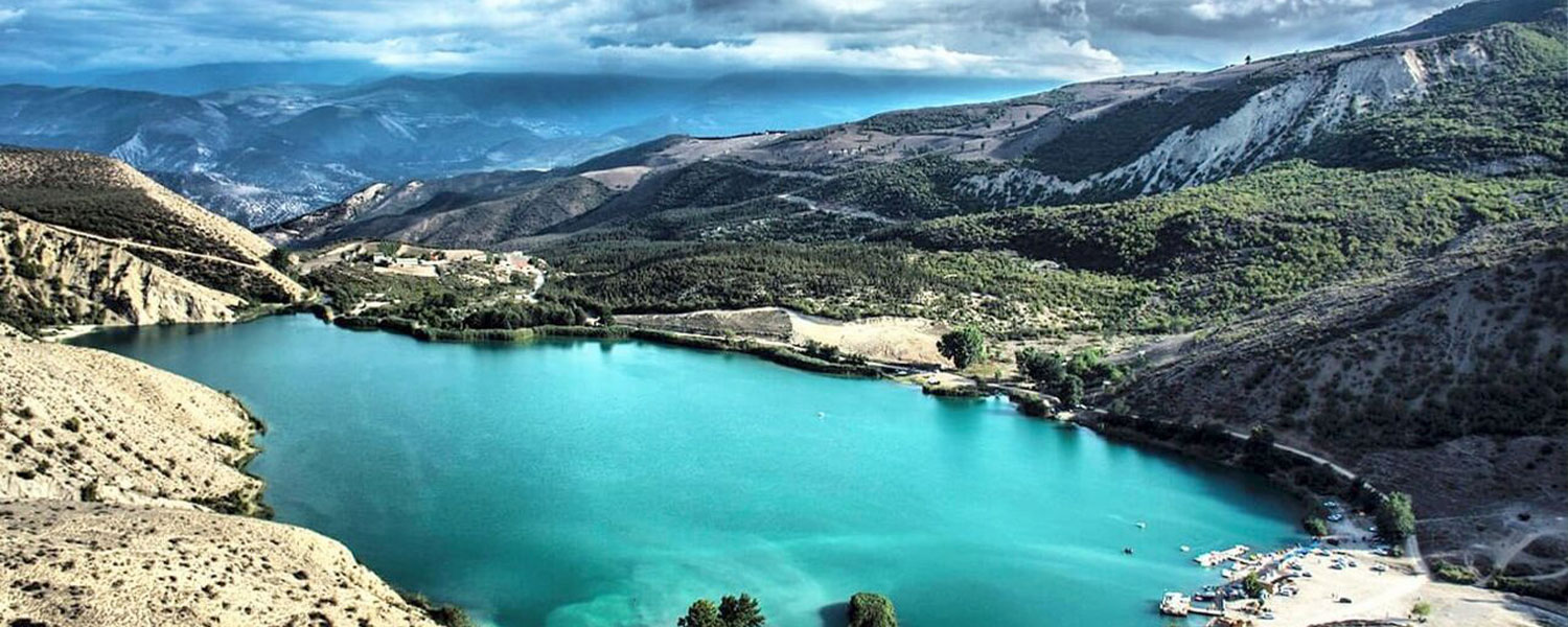
Tar and Havir lakes are among the mountain freshwater lakes that are located between the heights of Central Alborz. These lakes are located 30 km east of Damavand and at an altitude of 2,900 meters above sea level. Read the text and know more with IMT.
The lakes are located between the Dobarar mountain in the north and Zarrin kooh in the south. A trail from Dobrar mountain separates the two lakes, this trail is actually a hill that you have to cross when walking between two lakes. The two lakes of Tar and Havir are in a position surrounded by mountains, which are placed next to each other in such a way that a pit has been created between them. The same pit is filled with water and forms lakes.
Geologists believe that the formation of Tar and Havir Lake was caused by a landslide, which caused a natural dam to a depth of more than 50 meters and provided the necessary conditions for the accumulation of surface water. The maximum length of Tar Lake is 1 km and its width are 400 meters. The lake stretches from northwest to southeast. The depth of Tar Lake reaches 50 meters in high water seasons and 40 meters in low water seasons. Lake Havir is 400 meters long and 150 meters wide. The direction of this lake is north-south, the depth of Lake Havir is usually 15 meters. water level of these two lakes varies in different seasons. In winter, due to the cold weather, their surface freezes, but the lake water is cold in all seasons.
The source of Tar and Havir lakes are numerous springs at the bottom of the lakes. Lakes are mostly filled by the northern catchment. The snowmelt of the mountains of region; Qaradagh, Siahchal and Shahneshin provides this water. Seasonal waterways from Zarrin kooh in the south are also the source of water for the rest of the lake, also part of the seasonal waterways enters the lakes. The overflow of these lakes provides some of the source of the Tar River, which feeds on other tributaries to form the Tar River and flows to the city of Damavand.
Climate of Tar and Havir lakes
Due to its high altitude, this area is usually cold and always exposed to westerly winds. On the hottest days of the year, in the middle of July, when you come here, can enjoy the temperature of 18 degrees. Rainfall in the catchment area of these lakes is measured at 760 mm per year.
The best season to visit Tar and Havir Lake
Next to Lake Tar and Havir, you will see a new image in every season.
The best time to visit these two lakes is from early June to the end of summer. In July and August, it knows the proper water temperature and neutralizes the heat. In winter, the surface of the lake’s freezes, it is covered with snow and it is very spectacular. If you follow the safety conditions, you will have a happy trip.
It is interesting to know that even in May, snow may prevent reaching the lakes so IMT recommend you to ask before travelling to the region.
Flora and fauna of Tar and Havir lakes
Until recently, thyme grew around Lake Havir, but in recent years there has been no vegetation in the area due to soil erosion and weather problems. Inside the lake live a variety of salmon and around the lake live rams, whole Alborzi goats and ewes.
The best way to go to Lake Tar and Havir
There are two ways to reach Lake Tar and Havir:
- Route 1: Move from Tehran to Firuzkuh Road. After reaching Damavand, take the path of Chenar-e Shargh village. This route is 12 km of asphalt. After Chenar-e Shargh, continue the famous route to the mine road to the end. From here, 20 km is a rocky road to the lake. First, you will reach Tar lake, and by crossing it, you will reach Havir lake.
- Route 2: Move from Tehran to Firoozkooh Road. At 25 km from Firuzkuh, turn to the side road towards Yahar village. After passing through Yahar, you will reach the village of Moomej, then Dehnār, and then the village of Havir. From here to the lake is a 10 km thorough rocky First, you see Lake Havir; If you turn left, you will reach Havir lake, and if you continue the previous route, you will reach Tar lake.
Actually, route 1 is a rocky one and doesn’t have good quality. It is a narrow, rocky and mountainous road with steep slopes and dangerous turns and many precipices. This road is also full of bumps and you have to cross the Tar river several times along the way. So, IMT doesn’t recommend that.
It should be noted that there is no residential area between Chenar-e Shargh village and Tar lake, and in case of any problems, only passing vehicles should be used. Therefore, it is better to use this route only at suitable times of the day, holidays or in groups.
Let us also talk about the goodness of this path too; this route is more exciting and more spectacular and will be very attractive for off-road car fans.
Except for this; There are several paragliding, paragliding and kite sites in the area that you can enjoy watching flyers while crossing.