Central mountains of Iran
Central mountains of Iran
The central mountains of Iran are a long strip interrupted by deserts, and they are single. These mountains are called “central mountains” because of their extension in the center of Iran. These peaks are located from the city of Tafresh city with Noqreh Kamar Peak and on the way to the city of Babak in Kerman, they include the peaks of Barf Anbar, Kūh-e Palang-e Ābī, Viligia, Karkasin, Karkas mountain, Mil, Mount Marshenan, Shirkuh Peak, etc.Due to the location of each of these peaks individually in separate climate zones, they have their diversity of flora and fauna. The height of some of these peaks reaches more than 4,000 meters and they include some of the most technical peaks in Iran.
In the following, IRMTravel will introduce each peak of the central mountains of Iran.
The geographical location of the central mountains of Iran
The central mountain range of Iran stretches along the great diameter of Iran, from the northwest to the southeast, and connects East Azarbaijan province to the mountains of Sistan and Baluchistan. The central mountains of Iran are limited to the Zagros mountain range from the northwest and the west, and Alborz from the north, and dry lowlands are located in the south, and on the northern shores of the Persian Gulf and the Oman Sea, its height from the sea level reaches zero. In its east, there are two uninhabitable deserts, which are the Dasht-e Kavir in the north and the Dasht-e Lut in the south.
The border of these two deserts extends from around Kashan in the south to the Bastam region in the north of Shahrud. The length of the central mountain range is 1,460 kilometers and its width are 80 kilometers on average, and it covers an area equal to 143,000 square kilometers or 8.5% of the area of Iran.
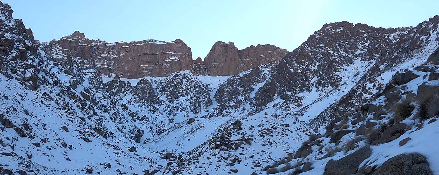
The weather of central mountains
Although the central mountains of Iran have natural glaciers in very few areas such as the mountains of Yazd and Taft provinces, they are generally almost dry like the eastern mountains. The high areas of these mountains have a mountainous climate due to their relatively high altitude. Due to the temperature difference between this mountain and the neighboring plains, various local wines are produced in the central areas of Iran.
The low humidity that is received from the western or southern currents due to the high altitude contributes to the relative moderation of the air in the highlands and foothills and has led to the settlement of people and the formation of different villages and towns on the slopes and foothills of these mountains.
Division of the central mountains of Iran
The central mountains of Iran are divided into two parts: the central continuous mountains and the Kerman mountains.
1- Qohrud, which is longer and higher, starts from the vicinity of Kashan and south of Tehran and continues to Kerman, this part is the continuous central mountains that include Barf Anbar, Domir, Karkas, and Shirkuh mountains.
2- Banan, which is the continuation of the Qohrud mountain, which continues to the Makran region in Sistan and Baluchistan province, includes the Kerman mountains.
The highest peaks are Hazaran, Lalezar, and Kūh-e Seh Shākh.
What is the highest peak of the central mountains?
Hazaran peak with a height of 4,501 meters is located in the south of Rayen district of Kerman province and is considered the highest peak in this province.
Mount Hazaran is called Hezar (thousand) because it has a thousand different types of plants, and it is the fourth highest mountain in Iran and the first in the center of the country.
The villages on the slopes of Hazaran mountain, with pleasant weather, which are located in the heart of this mountain, welcome many guests in the spring and summer.
It is a single peak that is bounded by the village of Sāhebābād, Esfahaniyote and Joupar mountain from the north, Rask, Dehmortezā, and Ordikan from the west, Ziaratgah village from the south, and Rayen from the northeast.
Also, Mount Hazar leads to Polvar and Joupar mountains from the north and Jebal Barez mountain from the south.
- Peak height: 4,501
- Starting point of the climb: 2,720
- Peak coordinates: 57.208055, 29.528633
Flora and fauna of Hazaran mountain
Buttercup, Thymes, Yarrow, Marjoram, Celeriac, Pennyroyal, Asafoetida, Mugworts, Milkvetch, Mushrooms, Rhubarb, Mountain Lettuce, Spring Onion, etc., make up the flora of this area. Also, the fauna includes animals such as Wolves, Wild Boars, Rabbits, Foxes, Partridges and etc.
The access route to the peak of Hazaran
The access route to the peak of Hazaran in Kerman province (southeast of Iran), Kerman city (distance from Tehran 980 km), Rayen city (at a distance of 100 km south of Kerman), and 15 km west of Rayen city after passing Tahrud village in the waterfall area It is the Rayen.
The most suitable season to climb the peak of Hajar is from the end of May to the end of October.