Zardkooh; hidden scenes of Zagros
Zardkooh; hidden scenes of Zagros
Zardkooh Bakhtiari or Zardkuh mountain range is located between the two great rivers Koohrang and Bazaft. This mountain with a length of 123 km and an average width of 20 km, in southwestern Iran and the westernmost part of Chaharmahal and Bakhtiari province and east and northeast of Khuzestan province. Zardkooh is one of the richest water reserves in Iran, the source of important rivers such as Karun, Karkheh, Zayandeh Rud and Dez so it’s really worth to climb this mountain. IMT tries to explain and discover all routes and hidden scenes of the region.
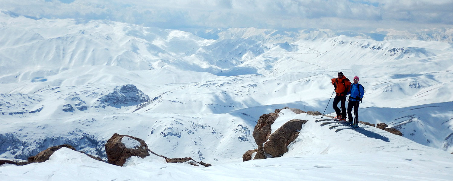
Let’s get ready to climb one of the most beautiful mountains of Iran. This mountain has many peaks above 3,000 meters and 4 important peaks above 4,000 meters. Klonchi (Klonchin) with a height of 4,221 meters, is the roof of Chaharmahal and Bakhtiari province and the highest peak of this mountain range. After Klonchi, the peaks of Haft Tanan with a height of 4,180 meters, Shah Shahidan with a height of 4,076 meters and Dozardeh with a height of 4,000 meters are the highest peaks of yellow mountain.
Guide to climb Klonchin peak
Klonchin peak (Klonchi) with a height of 4,221 meters above sea level, is the highest peak of Zardkuh mountain range. Klonchin peak is located in the south of the second dam of Koohrang tunnel, as well as in the south of Chelgerd city in Chaharmahal and Bakhtiari province.
There are several routes to climb this peak:
- North edge: This route is associated with rocks and many slopes near the first dam of Koohrang tunnel and Chalmishan peak.
- East Valley: The second dam of Koohrang tunnel, Kool Khedang valley, which is often covered with snow and is the fastest way to reach the peak in hot seasons.
- East edge: Khorsan refuge, which is a good route for winter climbing.
The route of Kool Khadang Strait is a beautiful route to climb Klonchin Peak. At the beginning of this route, you will see the high and amazing walls of the mountain with yellow and brown views and huge monolithic rocks, and in the continuation of the valley route, you will move from the vicinity of plants and grasses to finally long glaciers. Reach that it covers the whole valley and you have to walk for miles on these glaciers. Of course, the existence of these glaciers depends on the amount of snow and annual rainfall, and the number of glaciers may change in different years.
The other way to climb Klonchin Peak is to climb from the northern edge of the mountain and through Chalmishan route. This is a long way to climb Klonchin, which starts near the first dam and tunnel of Koohrang and after a long descent and descent, finally leads to somewhere in the middle or at the end of valley. The route is commonly used to climb the peaks adjacent to Klonchin, such as Dozardeh and Shah Shahidan peaks. It causes mistakes in navigating valleys and mountain ridges.
Discover other attractions of Zardkooh
Another feature of Zardkooh mountain range is that the longest mountain glacier, which is located in this mountain range.
Koohrang river is also one of the rivers that originates from the heights of Zardkooh and flows from the northern and eastern slopes of this mountain. This river flows in its natural bed towards Samsami region and then moves to Karun after joining Beheshtabad river.
flora and fauna of the region.
Here is some of the vegetation examples of the region: Zarrin Giah, Bilhar, Kooneh, Cardin, Jashir, Shahreh, Kajireh, Baboon Chamomile, Licorice, Onion, Astragalus, Badian. We guess you heard the names for first time because all of the vegetations are special for this region so search them in google to know more about.
Examples of animals: brown bear, leopard, whole and goat, ram and ewe, partridge, partridge, sea hawk, golden eagle, horned viper, tortoise, oak duck, Persian squirrel and etc…
YOU MAY LIKE: